Maps to Curb Malaria
Zambia, better data and community engagement help to combat the mosquito-borne disease

Did you know that maps can help combat malaria?
Fighting the disease at a large scale starts with knowing where people live so that officials can pinpoint where interventions are needed the most.
Jerry Maambo works as a malaria elimination officer in the Katete District of Eastern Zambia, where he saw a close to 50% surge in malaria cases in 2020 over the previous year.
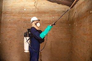
To combat the rise in malaria cases, Jerry’s district carried out extensive indoor residual spraying. These campaigns involve applying insecticides to the walls and ceilings inside of homes to kill malaria-carrying mosquitoes.
Since 2008, the U.S. President’s Malaria Initiative (PMI), led by USAID and co-implemented by the Centers for Disease Control and Prevention, has supported Zambia’s National Malaria Elimination Program to carry out more effective malaria interventions.
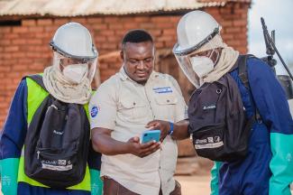
PMI’s VectorLink project worked with the Government of Zambia to create maps that enabled Jerry’s team to determine which areas needed more immediate intervention while planning large-scale spraying campaigns.
To create the maps, the PMI project worked with local partner Akros to use satellite images and field-verified data captured via Reveal, a geospatial data collection tool, to estimate local populations.


The new maps show smaller, more remote settlements, making efforts to control malaria more efficient and effective. Some of these communities may have been missed in previous campaigns to combat malaria through spraying or distributing insecticide-treated nets, but now they are on planners’ radars.
“With the PMI maps, we can target the structures that are eligible for the program. Now when you go to an area, you find that the number of structures indicated on the maps is exactly the number of structures there.” – Jerry
Unlike previous years, the new maps also show the distances between villages. This is important because the homes that are supposed to receive spraying should not be too far apart from each other to be more cost effective, so spray operators can maximize the number of houses sprayed. For remote, dispersed communities, nets make more sense, but planners still need to know how many people live there in order to supply enough nets.

With the new maps, the Zambian Government now has deeper insight into the geographic distribution of remote communities and better population estimates down to the village level.
PMI’s project also encourages the use of this data for decision-making. Jerry trained a team of sprayers to use the planning maps and other information — such as community acceptance levels, distances between settlements, and characteristics of the habitants — to inform campaign decisions.
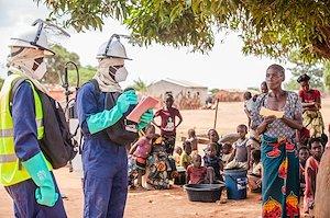
These sprayers, who wear personal protective equipment, are key partners in responding to community questions and concerns about the spraying campaigns.
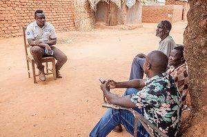
Indoor residual spraying is a community intervention and its success is dependent on the acceptance level of the community.” – Jerry


LOOKING AHEAD
In all, 20 PMI-supported districts received the new Reveal maps. By incorporating new digital tools, including satellite imagery, districts were better positioned to reach all settlements with life-saving malaria control by more accurately accounting for everyone and knowing which resources would be necessary.
So, what’s next? In addition to improved malaria control efforts, Jerry and his team are looking forward to continuing to use the maps in other ways. Recently, for example, they have started to use population data for water security, sanitation, and hygiene.
“We have also used the maps in identifying the areas that need sanitation facilities, for example the construction of latrines and drilling of water sources, so that we can assist these densely populated areas.” - Jerry

Learn more about USAID's Digital Development Awards. Follow @USAID.
ABOUT THIS STORY
Since 2008, the U.S. President’s Malaria Initiative (PMI), led by USAID and co-implemented by the Centers for Disease Control and Prevention, has been supporting Zambia’s National Malaria Elimination Program (NMEP) with projects like the PMI VectorLink Project. The PMI Zambia VectorLink Project is a model for harnessing the latest, most granular data to inform the planning and monitoring of malaria control interventions. The PMI Zambia VectorLink Project was selected as a winner of the 2022 Digital Development Awards.
Footnotes
Photos by Chipema Chinyama for USAID

